
Survey Research Institute
Overview
The Survey Research Institute (SRI) is among the 12 institutes connected to the National Water Research Center (NWRC), operating under the Ministry of Water Resources and Irrigation (MWRI). Established in 1975, SRI specializes in developing research related to modern surveying techniques and applying all modern aspects of geodesy, photogrammetry, remote sensing, and geographic information systems. The institute’s staff consists of a highly qualified, multidisciplinary research team capable of scientifically addressing development problems with sufficient practical experience.
Vision
To be a leading research institute of excellence in the field of geomatics and geographic Information Systems (GIS), and remote sensing (RS), to improve the accuracy and reliability of surveying measurements.
Mission
The Institute stands as a prominent research organization in the realm of surveying sciences, leveraging advanced technologies to enhance the precision and dependability of survey measurements. It focuses on developing innovative methods for field surveys and processes data scientifically to aim of accelerating the production and updating varies types of maps. Additionally, the Institute provides exceptional training courses in contemporary surveying techniques and extends consultancy services to both public and private sectors.
Departments
- Geometrical Geodesy Department
Updating precise geodetic control networks.
Utilizing the GNSS techniques to position the reference points on the national scale.
Establishing geodetic control networks for various purposes as cadastral movement monitoring and water resources management.
Surveying and mapping of several ancient sites for ground water monitoring and hazard assessment. - Physical Geodesy Department
Densification of gravity networks and gravity-anomaly map production for natural resources management.
Updating the mean sea level (MSL) observations using various modern tide gauges allocated along Mediterranean Sea and Red Sea. - GIS Department
Updating the base map of Egypt using GIS technology.
Developing a prototype GIS system for water resources management.
Establishing of spatial database for various research projects. - Remote Sensing Department
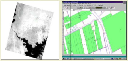
Applying the remote sensing techniques in producing various maps.
Utilizing satellite images for detecting different parameters and information using several spectral bands.
Monitoring changes detection of civil structures using various photogrammetric techniques.
Area of Expertise
- Establishment of reference points, cross sections along the watercourses in Delta Region for improving the irrigation system.
- Evaluating and updating the water gauges along the River Nile from Aswan to the Mediterranean Sea.
- Redefining the mean sea level (MSL) through establishing new tide gauges in Alexandria, Safaga, Suez and Port Said.
- Geoid determination for establishing national gravity network in Egypt using most accurate gravimeters that helps in producing highly accurate anomaly maps especially in regions around geological faults
- Establishment of geodetic control networks using GPS and satellite-based technology for the development of the south valley area.
- Establishment of vertical calibration base in Egypt. This base helps in the calibration of electronic instruments for surveying agencies
- Contribution with American International development Agency in performing Irrigation management systems Project in Egypt
- Establishment of the Egyptian National Gravity Standardization Network (ENGSN) by forming a cooperation channel with the American National Imagery and Mapping Agency.
- Contribution with many international universities and agencies. The institute organized many training courses in the fields of surveying science, geodesy, GIS and remote sensing.
- Producing topographic map for installing huge water pump station in Toshka.
- Reconstruction of the Egyptian National First Order Geodetic Network with the collaboration of the Egyptian Survey Authority (ESA).
- Establishment of 97 control points using GPS on the Egyptian-Palestine border, in cooperation with the Egyptian Military Survey.
- Renewal of geodetic control points in the governorates of Qena and Aswan for developing detail survey maps through the Egyptian German Project.
- Production of completely computerized cadastral and topographic maps for Al-Oboor city for the ministry of housing.
- Improvement of the navigation routes of the Damietta branch in cooperation with the Egyptian River Transportation Authority and the Hydraulic Research Institute.